KAKAMEGA COUNTY DEVELOPING A GIS POLICY
The County Government of Kakamega through the Department of Land Administration, Housing, Urban Areas and Physical Planning in collaboration with FAO’s Digital Land Governance Programme, (DLGP), Council of Governors and the State Department of Lands and Physical Planning has stepped up the process of developing a County GIS Policy to facilitate a seamless operations of digital land governance and management with an aim of enhancing economic development in the county.
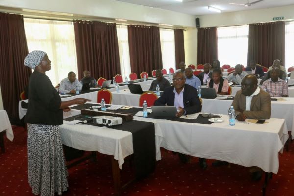
In a meeting graced by in-charge CECM Dr. Mariam Barasa together with Chief Officer Mr Justin Mutobera, it came to light that once developed, the Policy will provide the requisite technical support required to operationalize the current GIS lab in the County and facilitate easy collection, storage, retrieval, processing and analysis of geospatial data.
According to the CECM, a digitized land system will increase efficiency in governance of natural resources, control development of urban centres and boost revenue collection. It will also improve management of disasters as well as urban planning and management.
The meeting was facilitated by Officials from Food Agriculture Organisation (FAO) (Ms Zembi Odera) and Council of Governors Evans Kipruto and Arthur Mbatia.
Also in attendance were Kakamega Municipal Manager Mr Luke Otipo, Directors Stephen Chune (Physical Planning), Kevin Marangu (Housing) and Caleb Shiundu (Survey) as well as other officers from the Department.

